

Whether you are a seasoned angler or a beginner looking to land your first big catch, understanding where the fish are is half the battle. A salmon stocking map is an essential tool that provides a visual representation of where various agencies release fish into local waterways. These maps are not just about finding the best angling hotspots; they are a window into the complex world of river restoration and aquatic management.
In this guide, we will explore how to utilise these maps effectively, the science behind fish populations, and why these conservation efforts are vital for the health of our rivers.
What is a Salmon Stocking Map?
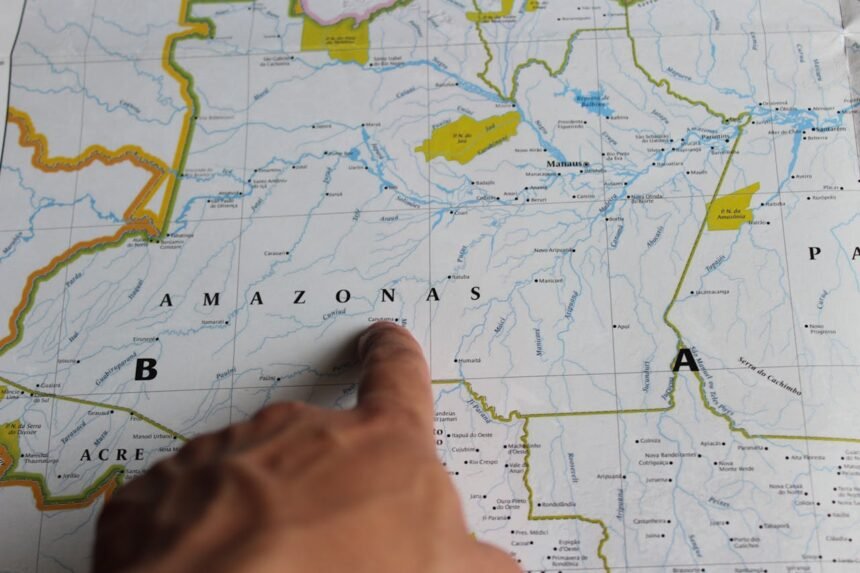
A salmon stocking map is a digital or printed resource, often provided by governmental bodies like the Environment Agency or local wildlife trusts. It tracks the release of hatchery-reared fish into specific river catchments. For anyone interested in freshwater fishing, this data is gold. It allows you to see exactly when and where young salmon (smolts) or adults have been introduced to boost numbers.
By studying these maps, you can identify locations where migratory patterns might be more concentrated, giving you a better chance of success while ensuring you stay within legally permitted zones.
The Role of Sustainable Aquaculture in Salmon Stocking
Stocking is not just about recreational fishing; it is a critical component of environmental protection. Many wild populations have declined due to habitat loss and pollution. Through sustainable aquaculture, scientists can breed fish in controlled environments to supplement wild stocks.
According to the Food and Agriculture Organization (FAO), responsible stocking helps maintain the ecological balance of river systems that have been impacted by industrialisation. When you look at a salmon stocking map, you are seeing the culmination of years of research and habitat preservation work.
Comparing Wild and Stocked Salmon
Understanding the difference between wild and stocked fish is important for both ethical angling and biological study. The following table highlights the key distinctions you might encounter on the riverbank.
| Feature | Wild Atlantic Salmon | Hatchery-Reared Fish |
|---|---|---|
| Genetics | Naturally diverse and adapted to specific rivers. | Often more uniform, bred for survival in early life. |
| Fins | Typically sharp, clean, and well-formed. | May show slight wear or rounding from hatchery tanks. |
| Behaviour | Highly cautious with strong migratory patterns. | Can be less wary initially but adapt quickly. |
| Purpose | Natural reproduction and biodiversity. | Supplementing fish populations and angling. |
How to Use a Stocking Map for Better Angling
If you want to improve your catch rate, you need to treat the salmon stocking map as a strategic blueprint. Here is how to get the most out of it:
- Identify Recent Releases: Look for “recent stocking events” on the map. Freshly stocked areas often see a temporary surge in activity.
- Check Access Points: Maps often highlight public access areas, helping you find a spot without trespassing.
- Verify Species: Ensure the map specifically details wild Atlantic salmon or the specific subspecies you are targeting.
- Cross-reference with Water Levels: Use SEPA or similar environmental data to see if water levels are conducive to fishing in stocked areas.
The Importance of a Fishing Licence
Before you head out to the coordinates found on your salmon stocking map, you must ensure you have a valid fishing licence. In the UK, this is a legal requirement. Revenue from these licences directly funds river restoration projects and the very stocking programmes you are benefitting from. You can learn more about the legalities via the Angling Trust.
Conservation and Habitat Preservation
While stocking provides a boost, the long-term goal for most environmentalists is the creation of self-sustaining spawning grounds. Organisations like the Atlantic Salmon Trust work tirelessly to ensure that rivers are clean enough for fish to thrive without human intervention.
Habitat preservation involves removing barriers to migration, such as old weirs, and improving water quality. A salmon stocking map often overlaps with maps of protected areas managed by NatureScot or the Wildlife Trusts, showing a holistic approach to nature recovery.
Key Factors in River Health
- Water Temperature: Salmon need cool, oxygen-rich water to survive.
- Substrate Quality: Clean gravel is essential for successful spawning grounds.
- Connectivity: Unimpeded access from the sea to the upper river catchments.
- Biodiversity: A healthy food web supported by freshwater fishing regulations.
The Science of Migratory Patterns
Salmon are famous for their incredible journeys from freshwater rivers to the saltwaters of the Atlantic and back again. Tracking these migratory patterns is vital for the accuracy of any salmon stocking map. Research shared by the International Council for the Exploration of the Sea (ICES) helps managers determine the best timing for releases to ensure smolts reach the ocean safely.
When we look at the ecological balance, we must consider the impact of climate change on these journeys. Warmer waters can disrupt the timing of migration, making the data provided by CEFAS and other scientific bodies even more crucial for modern conservation efforts.
Where to Find Reliable Data
For those in the UK, the best salmon stocking map resources are found through official government portals. Natural Resources Wales and Marine Scotland provide detailed regional breakdowns. For broader biological data, the National Biodiversity Network offers a look at species distribution across the country.
If you are interested in the history of these waters, the Freshwater Biological Association and the Game & Wildlife Conservation Trust offer extensive archives and research papers on how fish populations have changed over the decades.
Frequently Asked Questions (FAQs)
What is the best time of year to consult a salmon stocking map?
The best time is usually in the spring and autumn. Spring is when many stocking events occur to coincide with natural migratory patterns, while autumn maps often highlight spawning grounds that should be avoided to protect the next generation of fish.
Are stocked salmon safe to eat?
Generally, yes. Hatchery-reared fish are raised under strict health regulations. However, many rivers encourage “catch and release” to support conservation efforts. Always check local bylaws and health advisories from the Rivers Trust.
Does a salmon stocking map show wild fish locations?
Most stocking maps focus specifically on where hatchery-reared fish are released. However, because these fish often mix with wild populations, the map effectively shows you the most active river catchments for the species in general.
How can I help with river restoration?
You can help by purchasing a fishing licence, volunteering with a local river trust, and reporting any signs of pollution. Promoting environmental protection ensures that the angling hotspots we enjoy today will be there for future generations.